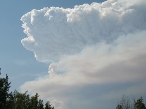
Pyrocumulonimbus in Wood Buffalo National Park, Canada (Photo by Mike Smith at 1400 MDT on 5 Aug 2014)
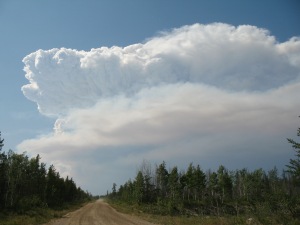
Pyrocumulonimbus in Wood Buffalo National Park, Canada (Photo by Mike Smith at 1400 MDT on 5 Aug 2014)
For those of us in the U.S., we’ve been hearing a lot about the wildfires burning in the west, from California up through eastern Washington. But areas of Canada have also seen a devastating fire season. In fact, it has been one of their worst in recorded history with 354 fires so far this year in the Northwest Territories, burning over 2.8 million hectares (Source: Northwest Territories Environment and Natural Resources, Forest Management Division).
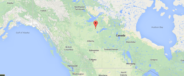
Mike Smith is a meteorologist with the Yukon Wildland Fire Management and has been offering on-site support for wildfires. He took these pictures on August 5 of a fire that started in the northwest portion of Wood Buffalo National Park and grew rapidly during August 3-5. To get ourselves oriented, here is a map showing where this park is located.
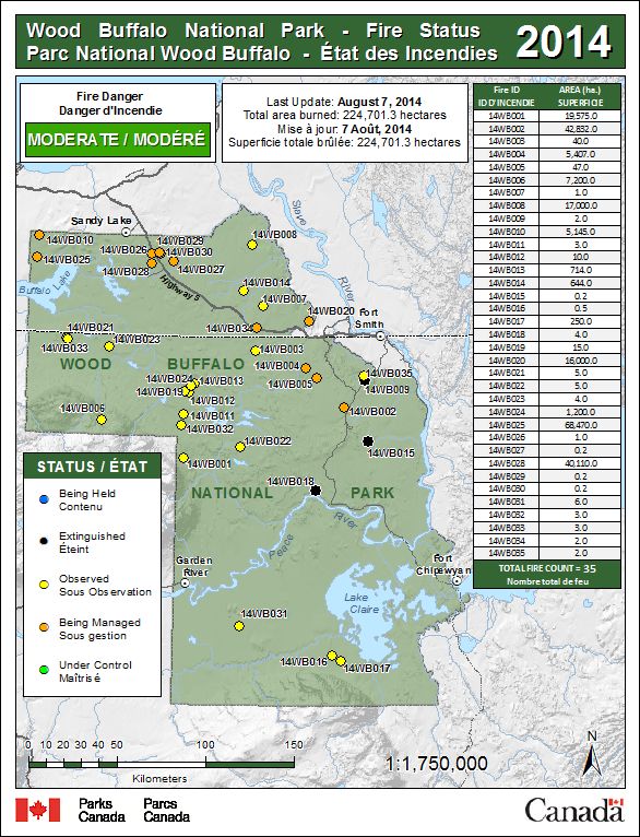
This particular fire, given the identifier 14WB-025, is one of many in this park on that day. This map from the Forest Fire Management Program shows the location of this fire in the northwest corner of the park, near Buffalo Lake; one noted as being managed.
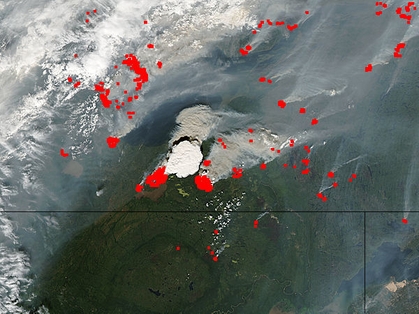
To put this fire in context of other fires in the greater region, this map, provided by the Canadian Wildland Fire Information System, shows fire “hotspots.” These are satellite pixels that indicate burning vegetation and may indicate one fire or several hot spots within a larger fire. You can see the high concentration of these hot spots in the Northwest Territories on the day the picture was taken, and this may even be underestimating hotspots if there was cloud cover involved.
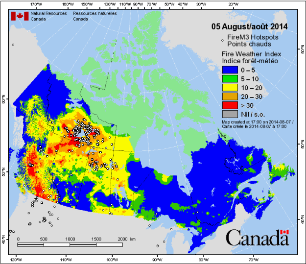
Fire “hotspots” derived from satellite infrared data. Courtesy of the Canadian Wildfire Information System.
Speaking of clouds, which is the purpose of this post, the heat from the fire rises rapidly into the atmosphere and cools, leading to condensation of water vapor to form cloud droplets. This heat typically produces even more intense upward motion than just the sun heating the ground on a warm summer day, and the ash/smoke in the air gives the clouds a darker appearance and can serve as nuclei for water droplets and ice crystals to form on. These storms can become so intense that they can produce rain and lightning; therefore technically being called “pyrocumulonimbus” clouds.
Luckily in this case, rainfall from this and other storms moving through helped to stall the growth as fire crews were protecting structures in a small community near the fire. Mike and the fire crews have been working hard to protect lives and property and deserve a huge thanks.
As if this pyrocumulonimbus cloud wasn’t impressive enough from the ground, the Moderate Resolution Imaging Spectroradiometer (MODIS) aboard the Aqua satellite passed over this location around that same time (20:20 UTC or 14:20 MDT), offering an incredible perspective of this cloud from above. Wow!
