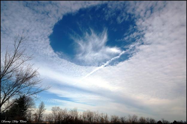
Fallstreak Hole, Contrail, Altostratus (Karl Kischel, Williamsburg, Missouri, 18 Feb 2016)
Hole punch clouds have fascinated sky watchers, scientists, and pilots since the 1940s. Nearly circular in appearance, the hole punch cloud can have streams of ice falling from its center (as in Karl’s picture), thereby giving a subset of these clouds the name fallstreak holes. These beautiful, fascinating atmospheric phenomena are created by aircraft penetrating cloud layer. In Williamsburg, it’s not unlikely to see planes ascending and descending due to the nearby busy St. Louis airport.
Fallstreak holes require a specific cloud type: mid-level altostratus or altocumulus clouds that exist between 6,500 and 20,000 ft above ground. At these altitudes, temperatures are well below freezing, but water droplets exist in liquid form at these sub-freezing temperatures, called supercooled water. To freeze, liquid water droplets need either a nucleus to freeze upon (either ice itself or a particle in the air such as dust, bacteria, fungal spores, volcanic ask, etc.) or temperatures to be below -40 degrees C to freeze spontaneously without a nucleus.
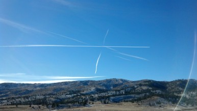
So how does an aircraft flying through supercooled water lead to freezing of drops and ultimately a fallstreak hole? We know that when aircraft fly high in the sky, at very cold temperatures (i.e., below -40 degree C), the water vapor in the jet engine exhaust rapidly freezes to form contrails across the sky, as can be seen in the photo above. But the key for fallstreak holes is the localized cooling that’s created around propellors and wings. Propellors push air outwards, causing the air to expand, which lowers the pressure and therefore cools the air. For jets, lower pressure exists above the wing compare to below, again leading to localized cooling of the air. This can cool the air to temperatures below -40 degree C, even when the aircraft is flying at lower temperatures, causing the supercooled water droplets in the cloud layer to spontaneously freeze where the aircraft passes through.
These ice crystals begin to grow at the expense of the nearby supercooled droplets, referred to as the Bergeron-Findeisen process. The vapor left behind by the evaporated supercooled droplet deposits onto the ice crystals thereby, along with the remaining supercooled droplets freezing on impact, allowing the ice crystals to grow.
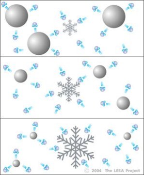
Drawing representing the Bergeron-Findeisen process: Ice crystals growing at the expense of water droplets
The freezing processes gives off heat, warming the surrounding environment.
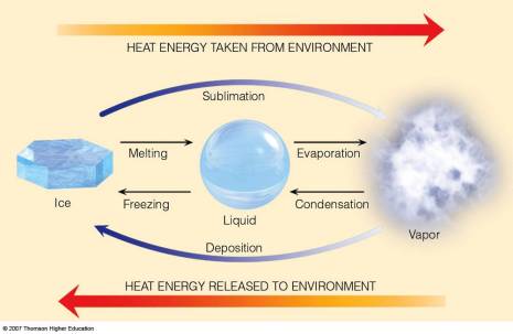
This warmer air rises, cools, and creates small circulations where downward (subsiding) air compensates for the locally rising air where the ice crystals are growing. The subsiding air warms, creating the hole.
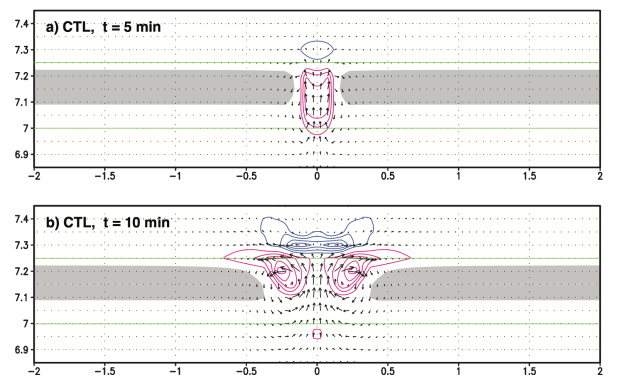
Computer simulations of a hole punch cloud showing heating (red), cooling (blue), and the corresponding circulations (black arrows). From Muraki et al. (2015).
These holes can spread for hours, lasting more than 4 hours at times, and the ice crystals can grow so large that they start to fall as snow, leading to the name fallstreak hole.
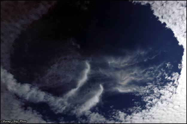
Zoomed in view of the hole punch cloud showing the fall streaks (Karl Kischel, Missouri, 18 Feb 2016)
On 18 February 2016, Karl was lucky enough to photograph two of these hole punch clouds over Williamsburg, Missouri.
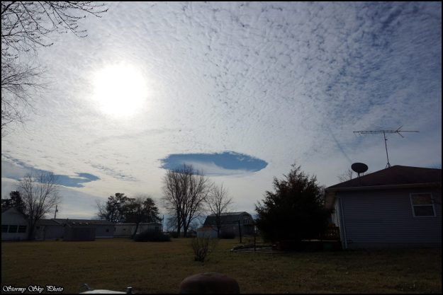
Two fallstreak holes, Karl Kischel, Williamsburg, Missouri
These fallstreak holes could also be seen on visible satellite imagery! Those in the circle are the same ones Karl was photographing. Notice there’s a third one nearby. In fact, because these are visible from satellites, scientists have used high-resolution satellite data to look at the occurrence of fallstreak holes around major airports in the U.S. They found that they occur 3-5% of the time on average per year, and about 15% of the time during the winter (when we’re most likely to see these altocumulus/altostratus cloud layers).
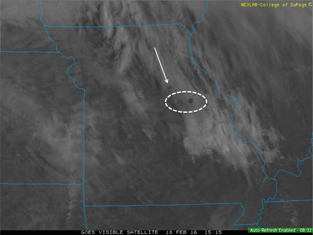
GOES Visible Satellite image from 15:15 UTC on 18 February 2016 showing the fallstreak holes.
Besides wanting to know your chances of seeing these beautiful hole punch clouds in the sky, why is it important to know how often they occur? There’s an argument that the increased snow that falls from the holes could mean more de-icing would be required at the airport before takeoff.
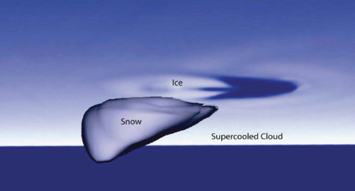
Computer simulation after 60 minutes from when ice was introduced into the cloud layer. From Heymsfield et al. (2011)
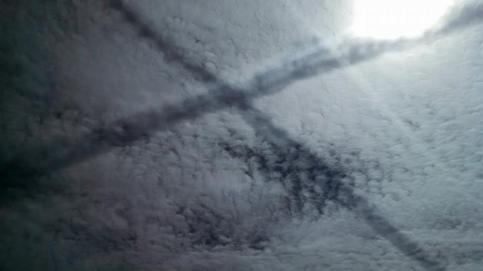
Thanks for the great pictures, Karl! Enjoy additional photos he took from that day.





 (
(