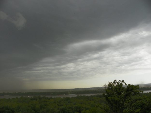
Eileen Lenkman, 7 May 2016, eastern Missouri looking across Mississippi River toward Illinois
On May 7, 2016, a line of storms moved through the midwest. Eileen Lenkman shared a series of photos from eastern Missouri as the storms moved from the NW toward the SE.
In this first photo, the storm can be seen approaching the area.
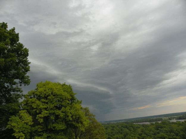
Eileen Lenkman, 7 May 2016, eastern Missouri looking toward Illinois
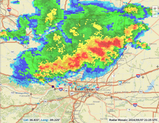
Composite radar imagery at this time shows the extent of this precipitating system as it moves toward the St. Louis area.
In the next photo, the heavily raining portion of the storm appears in Eileen’s view.
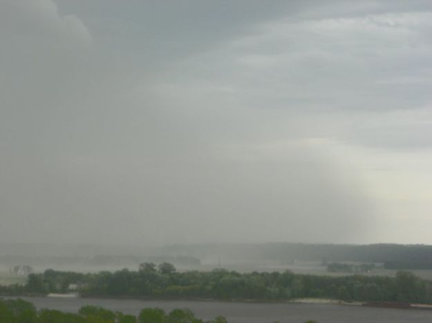
Eileen Lenkman, 7 May 2016, eastern Missouri looking toward Illinois
The rain locally cools the air, which spreads out near the ground away from the raining core of the storm. The leading edge of this rain-cooled air is referred to as a gust front and is typically accompanied by strong winds.
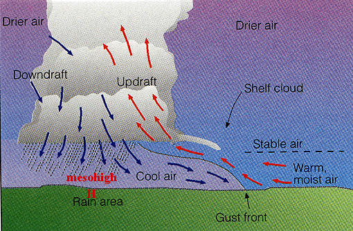
Schematic showing the gust front at edge of rain-cooled air
Not only is there a marked temperature distance across the gust front between the rain-cooled air behind it and the warm, moist air ahead, difference in wind speed and direction behind and ahead of the gust front can create considerable horizontal wind shear across that boundary far out ahead of the raining core of the storm. The warm, moist air is lifted up and over the colder dense air behind the gust front. This upward motion can tilt and vertically stretch the small-scale vortices that can form along the edge of the gust front due to the horizontal wind shear, creating a spinning vortex that can extend upward from the ground; this is casually referred to as a “gustnado.”
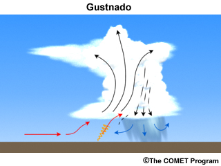
This shallow, short-lived vortex may only extend upward 10s of feet above the ground with no apparent connection to the cloud above. Away from the raining core, a debris cloud or dust whirl is seen near the surface. Wind speeds can reach 60-80 mph in these gustnadoes, but they are not considered to be a tornado as they are not associated with any sort of parent rotation in the cloud above.
On 7 May 2016, when the storms were moving near St. Louis, Eileen Lenkman captured one of these gustnadoes on camera.
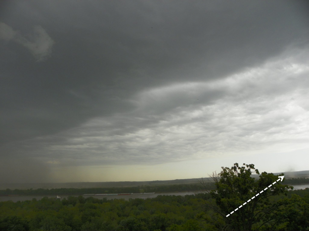
Gustnado, Eileen Lenkman, 7 May 2016, eastern Missouri looking toward Illinois
In this photo, the raining core can be seen to the far left of the photo while out to the right the small debris whirl near the surface can be seen at presumably the leading edge of the gust front.
